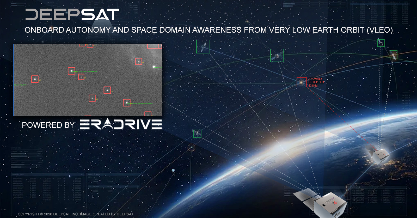
Los Angeles, CA – November 17, 2026 – DeepSat, Inc., which is building Orion’s Belt, a very low Earth orbit (VLEO) space intelligence platform, and EraDrive, Inc., a developer of onboard autonomy for spacecraft, today announced a partnership to bring onboard autonomy and space domain awareness (SDA) to VLEO. The companies have signed a memorandum of understanding that sets out the framework for the collaboration.
Under the partnership, the companies will work on:
- Demonstration: assessing the integration of EraDrive’s onboard autonomy on DeepSat’s first satellite, working toward an on-orbit demonstration of onboard detection and tracking of space objects from VLEO;
- Space object detection and tracking: joint analysis of onboard SDA and space situational awareness (SSA) performance from VLEO, including detection range, tracking accuracy and coverage of objects in low Earth orbit and higher orbits;
- Navigation: applying EraDrive’s GNSS-independent position, navigation and timing (PNT) to VLEO operations, so DeepSat satellites stay resilient in contested environments; and
- Roadmap: a plan to scale the capability across the Orion’s Belt constellation of approximately 500 satellites, turning each satellite into a node in a distributed SDA network connected by inter-satellite links.
From a baseline altitude of approximately 250 km, an Orion’s Belt satellite sits below nearly every other object in orbit. It can observe them against the dark background of space, at shorter range than ground-based sensors and without weather or daylight limits. The VLEO regime itself is also becoming more crowded, increasing the need to track the objects that operate there.
EraDrive’s autonomy software has heritage from six formation-flying missions and 13 satellites, and reached Technology Readiness Level 9 on NASA’s Starling swarm, where it is flying today. It performs onboard detection and classification of space objects, navigation independent of GNSS, and collision avoidance, reducing dependence on ground control and cutting latency. Combined with DeepSat’s VLEO platform, onboard AI processing and low-latency data relay, the partnership is intended to deliver timely space object awareness to defense, allied government and commercial customers.
“Very low Earth orbit gives us a vantage point that looks up at nearly everything else in space. And EraDrive has already proven onboard autonomy in orbit. Pairing it with DeepSat’s Orion’s Belt lets us turn that vantage point into Space domain awareness (SDA) our customers can act on in minutes, not hours.”
— Hayk Martirosyan, Co-Founder and CTO, DeepSat
“Every satellite should be able to see what is around it and act on it without waiting for the ground. VLEO is a vantage point very few operators have, and DeepSat is moving fast to claim it. We are excited to take the autonomy we have proven in LEO on multiple satellites down to VLEO and help turn Orion’s Belt into a network of satellites that watch the sky and space around them for each other.”
— Sumant Sharma, Co-Founder and Chief Executive Officer, EraDrive
About EraDrive
EraDrive, Inc. builds the autonomy platform that lets spacecraft see, reason and act on their own. Its AI-native flight software and low-SWaP hardware handle perception, trajectory optimization, alternative PNT and collision avoidance onboard, independent of GNSS and ground control. Founded in 2025 by Sumant Sharma, Simone D’Amico and Justin Kruger and built on research from Stanford’s Space Rendezvous Laboratory, EraDrive’s technology has heritage from six formation-flying missions and 13 satellites and is flying today on NASA’s Starling swarm. EraDrive is headquartered in Palo Alto, California. Learn more at eradrive.space.
Media contacts: DeepSat Team, info@deepsat.com · EraDrive Team, info@eradrive.space
About DeepSat
DeepSat is developing an advanced satellite constellation in very low Earth orbit (VLEO), combining high revisit rates with in-orbit AI for sensor fusion. The platform enables resilient, near-real-time, AI-powered Earth intelligence for critical missions such as vessel detection, energy infrastructure monitoring and disaster assessment across civil, commercial and defense.